K Fellfarers - the outdoor club for people in south Cumbria
Gallery 2014 - January
High tides and storms lashed the British coastline at the start of the month resulting in lots of flooding. This photo from the Guardian on Saturday Jan 4th shows Sandside at the bottom of Storth Road. |
|
|
|
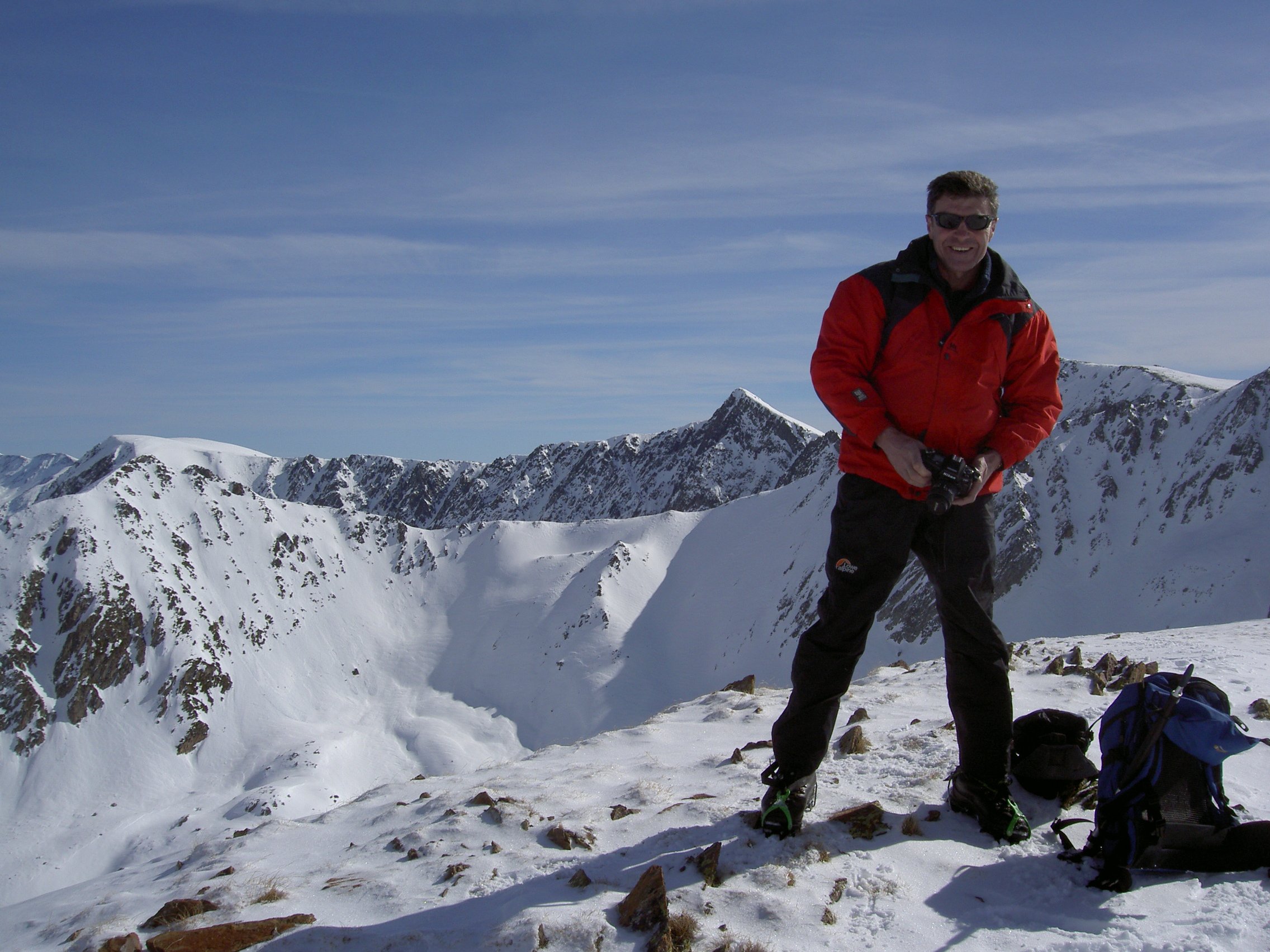
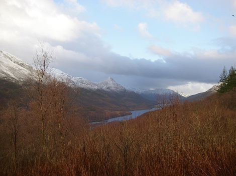
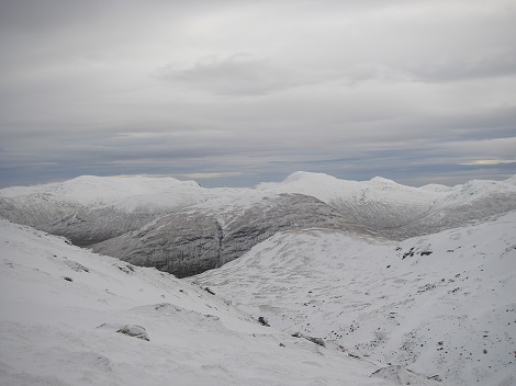
Glencoe meet Mick, Alan, Graham, Veronica, Frank, Mel, Charles, Alvin, Hugh |
|
.jpg) |
Mick, Alan, and Hugh drove up on Thursday afternoon to meet up at the Drovers at Inverarnan with Mel and two friends from Bassetlaw MC, Charles and Alvin. Here they are in the Drovers planning the following day prior to having a meal. From left to right: Mick, Mel, Charles, Alvin, and Alan. |
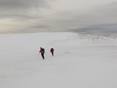
Friday dawned wet as per the forecast, and two groups set out. Mel and Alvin walked up the Munro Ben Vorlich, and the other four who had already done it attempted the Corbett Meall an Fhudair (which Hughie had already done). Below are Mick, Hughie, and Alan setting out. |
Here are Hugh, Mick, and Alan on the wet summit of Troisgeach, with Charles behind the camera.
|
 |
.jpg) |
.jpg) |
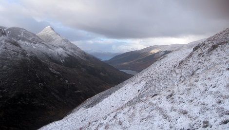
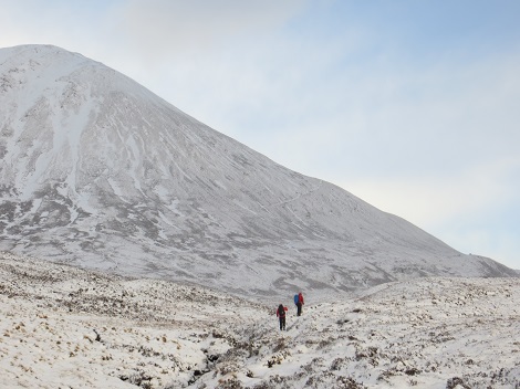
Saturday was a better day, and the nine people set out in four different groups. Graham and Frank had some good skiing on the Glencoe ski runs. Veronica and Alan did a local walk. This photo is from Alan showing the Pap of Glencoe above the lovely trees and lochan near Glencoe village.
|
Mick and Hugh walked up the Corbett Garbh Bheinn, a hill that both had been 'weathered off' previously. Ascending Garbh Bheinn, looking towards the Pap |
 |
 |
Looking over to the Aonach Eagach ridge |
Hugh on the first top |
 |
|
Mick on the summit of Garbh Bheinn looking north |
Hugh on the summit of Garbh Bheinn with Loch Leven behind and the Pap just to his right |
.jpg) |
 |
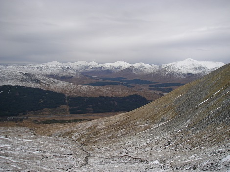
Mel, Charles, and Alvin ascended the Munro Sgurr Eilde Mor from Kinlochleven. The pap from near Mamore Lodge |
On the way to Sgurr Eilde Mor , with the route going up the slopes of Sgurr Elide Beag. |
 |
.JPG) |
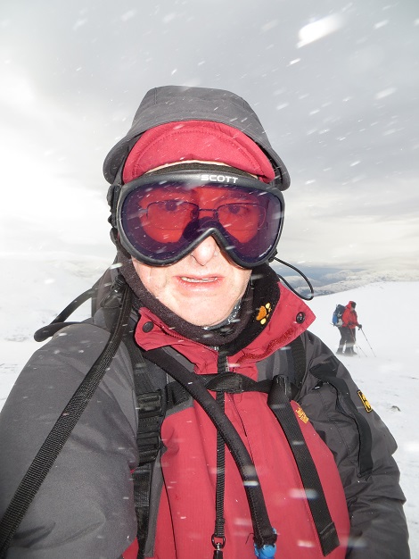
Mel and Alvin on the windy summit |
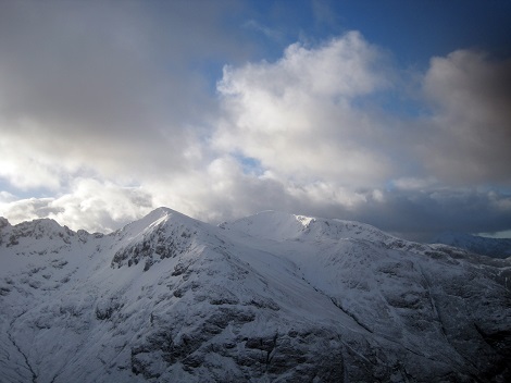
The view from the summit looking over to Buachaille Etive Mòr |
.JPG) |
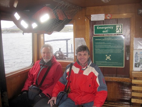 |
Sunday was a poor forecast, but turned out better. whilst Alan, Mick, and Hugh increased the clubs island count to 2 by ferrying over to Lismore and back. Here are Hugh and Alan on the passenger ferry from Port Appin |
Mick and Alan on Lismore |
.jpg) |
 |
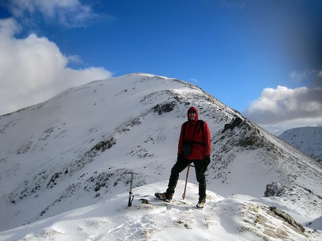
On the way home Mel, Charles and Alvin ticked off Beinn an Dothaidh from the Bridge of Orchy Here is Charles in his winter gear. |
On the summit plateau/ridge |
 |
 |
Looking east |
On the descent back to Bridge of Orchy
The five bed chalet Rowan has been booked again for next year for £200. We'll have to wait and see whether there is enough demand for a second or third chalet later in the year. |
 |
Quiet weekend at High House Val, Margaret and Roger, Sandra and Tony, Fred, Mark, Sue and Tony, Clare and Mick, Angie and Hugh, Nancy and Paul, Andrew |
|
.jpg) |
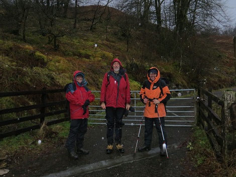
A good turn out for the winter walking weekend, which for various reasons had this year been this entitled a 'Quiet Weekend'. Tony and Sue parked at Seatoller, caught the bus to Keswick, and then walked back to Seatoller via Cat Bells and Maiden Moor. Most other people met up at High House. Friday night in High House, clockwise from Val with her back to the camera: Margaret, Tony A, Roger, Fred, Sandra, Mark, Tony M, Sue, Clare, Angie, and Mick. |
Andrew Campbell (Alan Campbell's son) drove up from Bristol very early Saturday morning, and had a good walk via Grains Ghyll to Bowfell and Crinkle Crags, returning via Great Gable and Green Gable. All in all, a wet day, but all managed to get out. Most had a meal in the Scafell in the evening. Sunday was wet again, and most people drifted home. |
.jpg) |
Mid-week Walk - The Trough From left to right outside Leighton Moss after coffee - |
|
 (3).jpg) |
|
One of the highest number of Fellfarers and friends ever assembled for a mid-week walk enjoyed an interesting walk along the line of the geological feature called The Trough. Perhaps the weather forecast had attracted them as it was due to be fine all day: amazing in a spell of seemingly never ending grey skies and drizzle. 21 members assembled at Arnside station and caught the 10.50 train to Silverdale, joining three members who caught the train from Grange. Ruth met up with us at Silverdale station, and all piled into the RSPB reserve at Leighton Moss for coffee. |
|
 (4).jpg) |
The first stop was at the start of the Trough, where Hugh made an attempt at showing how it was created - Left. Thanks to Colin Patrick WGS for background information on the Silverdale Disturbance. |
Walking along the line of the Trough, the group entered Trowbarrow, where some members have climbed over the years. Its instability has put most members off in recent years and the classic lines like Jean Jeannie remain a thing of the past. |
 (1).jpg) |
 (5).jpg) |
Passing under Red Wall, the group climbed out of the quarry and back into the Trough, negotiating a wall at one point - Left. This wall represents the boundary between Trowbarrow (now a reserve) and Leighton Hall private land, but most of us didn't see the Private Keep Out sign. |
The Trough runs out around Haweswater in Gaitbarrows, and lunch was taken just before Leighton Beck: the county boundary between Lancashire and Cumbria - Right. Its a good place to lunch with views over Silverdale Moss. Birds seen included a flock of lapwings (technically a desert or a deceit of lapwings), egrets, and seven swans flying in formation overhead. |
 (2).jpg) |
 (6).jpg) |
Hazelslack Farm (now with no peacocks) was passed, and the Trough picked up again in Storth at Cockshot Lane, where Through's Lane appears to be a corruption of Trough. The return to Arnside was made along the old Hincaster to Arnside railway line. On the left is its route through the cutting between the Ship pub and St Johns Cross - another kind of trough!. The leader later gave his apologies for the length of the walk, as it was probably about 8 miles rather than his estimate of 5. |
| ©2007 Wizard Wheeze Promotions | |
.jpg)
.jpg)